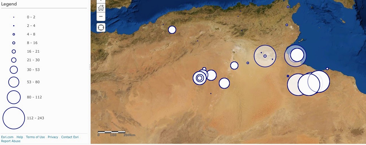
The following is a map of the geographical distribution of Ibāḍī scholars in the Maghrib from the 1st-15th centuries hijrī. I posted an earlier map of this data in the Gephi program, but the volume of scholars in the same location was not weighted. This graph shows the volume of scholars in the same location according to size and I think it is very telling about the dominance of certain geographic regions. The program was created using the free, online version of ArcGIS (http://www.arcgis.com/features/)
الصورة التالية هي خريطة التوزيع الجيوغرافيّ لدى العلماء الإباضية في المغرب العربيّ من القرن الأوّل إلى القرن الخامس عشر الهجري. وضعت خريطة سابقا مبنية على نفس البيانات ولكنّ كثرة العلماء من نفس الأماكن لم تظهر. أما هذه الخريطة
فهي تظهر كثرة العلماء في نفس المكان وأعتقد أنّها تظهر أهمية بعض المناطق بطريقة واضحة جدا. الخريطة مرسومة اسخداما
للبرنامج المجاني
"ArcGIS"
المتوفّر بالعنوان التالي
http://www.arcgis.com/features/

